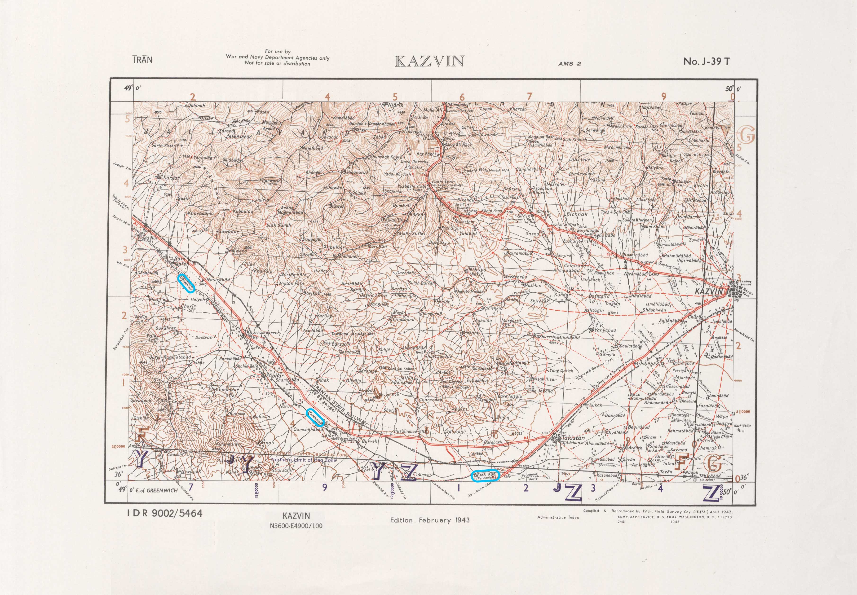
ملف:Historic Map of Abhar-River.jpg
حجم هذه المعاينة: 800 × 555 بكسل. البعدان الآخران: 2٬560 × 1٬778 بكسل | 3٬622 × 2٬515 بكسل.
الملف الأصلي (3٬622 × 2٬515 بكسل حجم الملف: 879 كيلوبايت، نوع MIME: image/jpeg)
وصف قصير
| ⧼wm-license-information-description⧽ |
(فارسية) |
| ⧼wm-license-information-date⧽ | 2023, {{time}} – invalid date format 20 (help) |
| ⧼wm-license-information-source⧽ | ⧼Wm-license-own-work⧽ |
| ⧼wm-license-information-author⧽ | Alim arjmandi |
36°37′00″N 49°50′00″E / 36.616667°N 49.833333°E J-39-T
ترخيص
|
تاريخ الملف
اضغط على زمن/تاريخ لرؤية الملف كما بدا في هذا الزمن.
| زمن/تاريخ | صورة مصغرة | الأبعاد | مستخدم | تعليق | |
|---|---|---|---|---|---|
| حالي | ★ مراجعة معتمدة 21:14، 15 أكتوبر 2023 | | 3٬622 × 2٬515 (879 كيلوبايت) | Pastakhov (نقاش | مساهمات) | Upload https://upload.wikimedia.org/wikipedia/commons/e/ee/Historic_Map_of_Abhar-River.jpg |
لا يمكنك استبدال هذا الملف.
وصلات
لا يوجد صفحات تصل لهذه الصورة.