ملف:Guayana Esequiba (zona completa).png
حجم هذه المعاينة: 598 × 600 بكسل. البعد الآخر: 784 × 786 بكسل.
الملف الأصلي (784 × 786 بكسل حجم الملف: 830 كيلوبايت، نوع MIME: image/png)
وصف قصير
| ⧼wm-license-information-description⧽ |
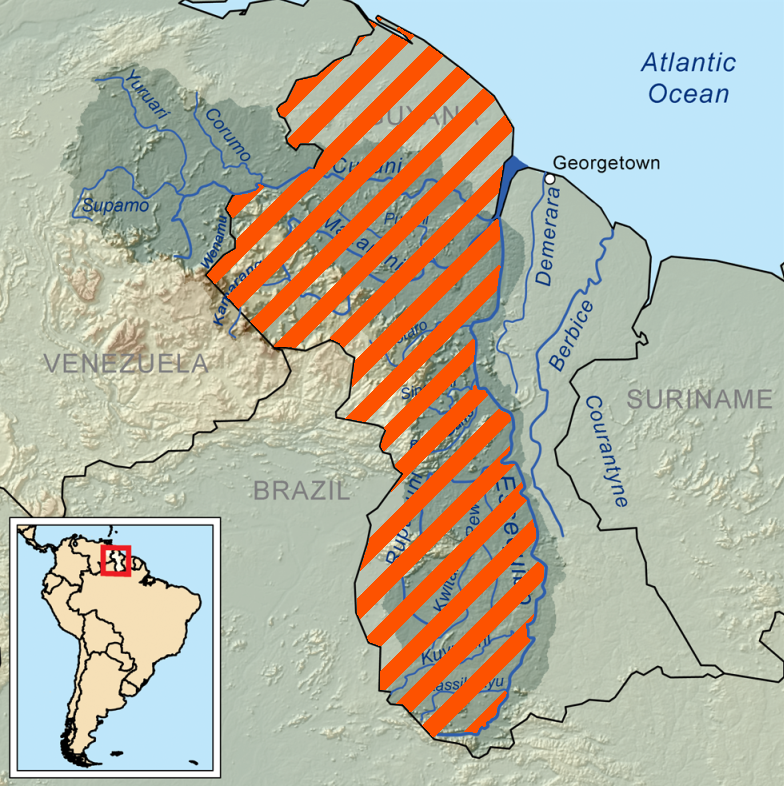
Español: Mapa de la Guayana Esequiba; la zona rayada en naranja constituye el área reclamada por Venezuela.
|
| ⧼wm-license-information-date⧽ | 2010-12-23 19:07 (UTC) |
| ⧼wm-license-information-source⧽ | |
| ⧼wm-license-information-author⧽ |
|
.png&action=edit&redlink=1)
| [This is a retouched picture, which means that it has been digitally altered from its original version. Modifications: resized, striped. The original can be viewed here: Essequiborivermap.png. Modifications made by Kordas.] Error: {{Lang}}: text has italic markup (help)
|
ترخيص
|
قالب:Original upload log
This image is a derivative work of the following images:
- File:Essequiborivermap.png licensed with Cc-by-sa-3.0
- 2010-04-07T17:53:14Z Kmusser 1000x1000 (1483371 Bytes) Added topology (source: SRTM)
- 2008-09-11T17:15:09Z Kmusser 1000x1000 (344007 Bytes) {{Information |Description=This is a map of the [[:en:Essequibo River|Essequibo River]] drainage basin. |Source=Own work using [[http://www.maproom.psu.edu/dcw/ Digital Chart of the World]] and [[http://edc.usgs.gov/products/
تاريخ الملف
اضغط على زمن/تاريخ لرؤية الملف كما بدا في هذا الزمن.
| زمن/تاريخ | صورة مصغرة | الأبعاد | مستخدم | تعليق | |
|---|---|---|---|---|---|
| حالي | ★ مراجعة معتمدة 09:51، 1 ديسمبر 2023 | | 784 × 786 (830 كيلوبايت) | Pastakhov (نقاش | مساهمات) | Upload https://upload.wikimedia.org/wikipedia/commons/1/11/Guayana_Esequiba_%28zona_completa%29.png |
لا يمكنك استبدال هذا الملف.
وصلات
لا يوجد صفحات تصل لهذه الصورة.
.png&oldid=3649459)