ملف:Zonal band.svg

حجم معاينة PNG لذلك الملف ذي الامتداد SVG: 596 × 599 بكسل. البعد الآخر: 2٬037 × 2٬048 بكسل.
الملف الأصلي (ملف SVG، أبعاده 717 × 721 بكسل، حجم الملف: 60 كيلوبايت)
وصف قصير
| ⧼wm-license-information-description⧽ |
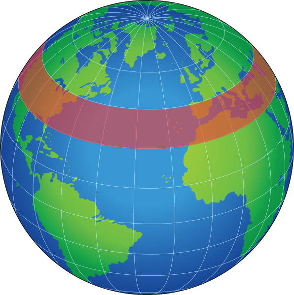
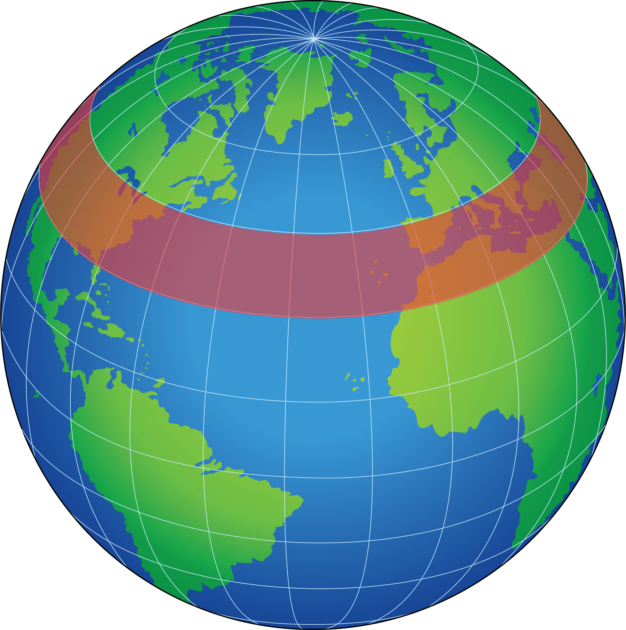
English: zonal band, a latitudinal circle (east-west direction) having any width in degrees latitude, used for the representation of data for an area of Earth's surface or atmosphere
|
| ⧼wm-license-information-date⧽ | 2012-01-23 00:08 (UTC) |
| ⧼wm-license-information-source⧽ | قالب:Derived from |
| ⧼wm-license-information-author⧽ |
|
| [This is a retouched picture, which means that it has been digitally altered from its original version. Modifications: Vectorized. The original can be viewed here: Globe_Atlantic.svg. Modifications made by Hazmat2.] Error: {{Lang}}: text has italic markup (help)
|
ترخيص
قالب:Original upload log
This image is a derivative work of the following images:
- File:Zonal_band.gif licensed with PD-USGov-NASA
- 2006-06-25T04:31:49Z Pflatau 485x485 (11219 Bytes) http://mynasadata.larc.nasa.gov/glossary.php?&word=ALL zonal band: a latitudinal circle (east-west direction) having any width in degrees latitude, used for the representation of data for an area of Earth's surface or atmos
- File:Globe_Atlantic.svg licensed with PD-USGov-Military
- 2008-10-18T20:04:36Z Clindberg 717x721 (60406 Bytes) {{Information |Description={{en|1=Globe graphic, centered on the northern Atlantic Ocean.}} |Source=Extracted from PDF version of the [http://www.disam.dsca.mil/pubs/archives.htm Vol 26-4 2004 DISAM Journal] (direct PDF URL [
تاريخ الملف
اضغط على زمن/تاريخ لرؤية الملف كما بدا في هذا الزمن.
| زمن/تاريخ | صورة مصغرة | الأبعاد | مستخدم | تعليق | |
|---|---|---|---|---|---|
| حالي | ★ مراجعة معتمدة 11:01، 4 نوفمبر 2023 | | 717 × 721 (60 كيلوبايت) | Pastakhov (نقاش | مساهمات) | Upload https://upload.wikimedia.org/wikipedia/commons/c/c6/Zonal_band.svg |
لا يمكنك استبدال هذا الملف.
وصلات
لا يوجد صفحات تصل لهذه الصورة.