ملف:Chucuito Titicaca Aerial.jpg
حجم هذه المعاينة: 800 × 600 بكسل. البعدان الآخران: 2٬560 × 1٬920 بكسل | 4٬000 × 3٬000 بكسل.
الملف الأصلي (4٬000 × 3٬000 بكسل حجم الملف: 4٫82 ميجابايت، نوع MIME: image/jpeg)
وصف قصير
| ⧼wm-license-information-description⧽ |
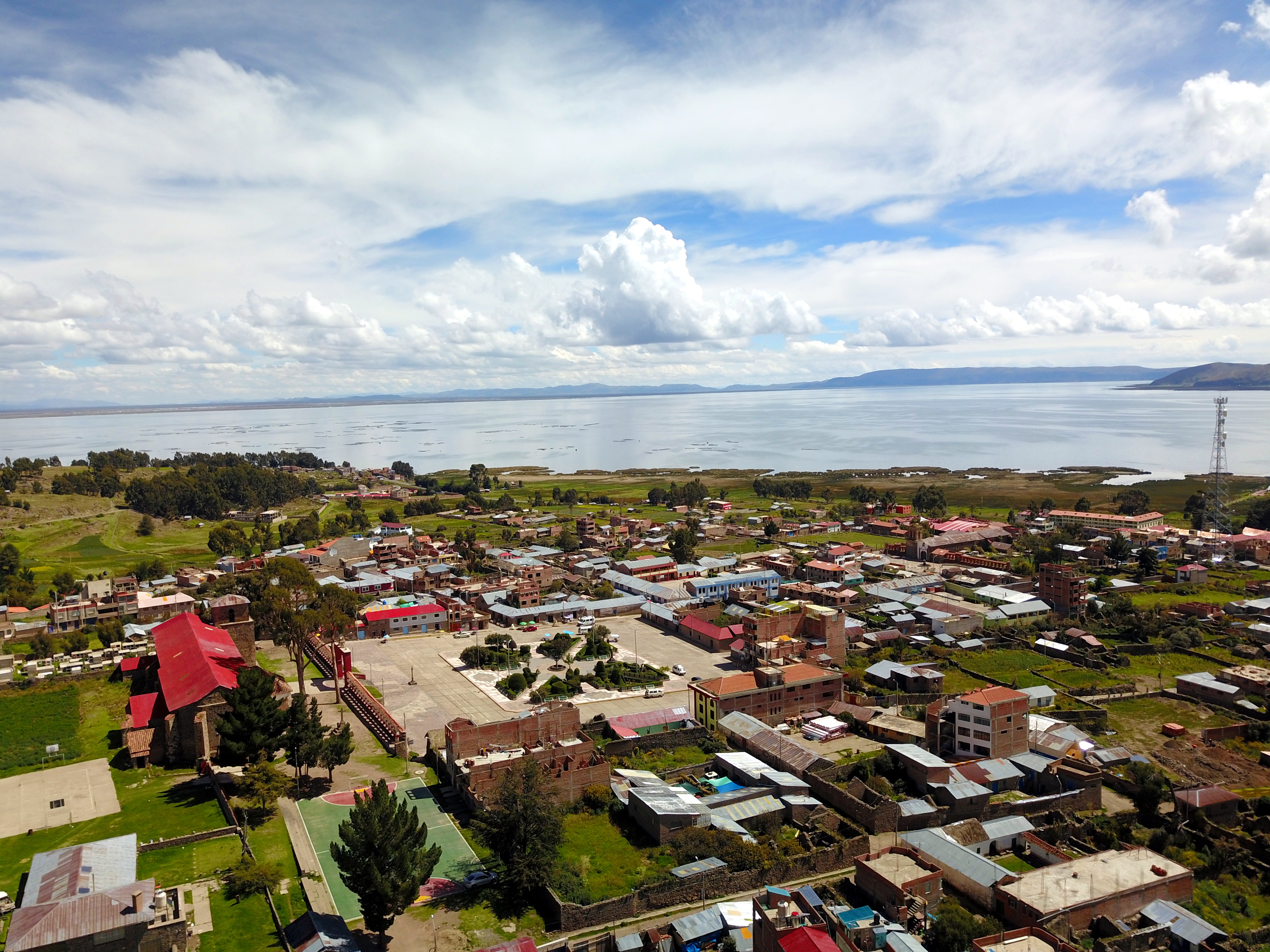
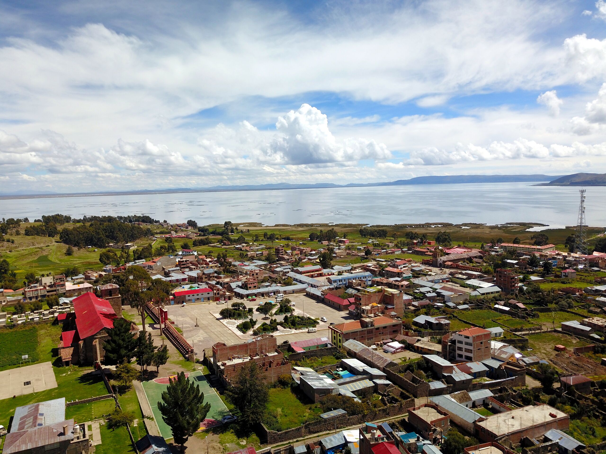
English: Chucuito, a village on the banks of Lake Titicaca, is located about 20 km from Puno.
|
| ⧼wm-license-information-date⧽ | 2019, {{time}} – invalid date format 41 (help) |
| ⧼wm-license-information-source⧽ | ⧼Wm-license-own-work⧽ |
| ⧼wm-license-information-author⧽ | Jaimalalatete |
15°53′47″S 69°53′23″W / 15.89652°S 69.889729°W
ترخيص
|
تاريخ الملف
اضغط على زمن/تاريخ لرؤية الملف كما بدا في هذا الزمن.
| زمن/تاريخ | صورة مصغرة | الأبعاد | مستخدم | تعليق | |
|---|---|---|---|---|---|
| حالي | ★ مراجعة معتمدة 00:09، 8 أكتوبر 2023 | | 4٬000 × 3٬000 (4٫82 ميجابايت) | Pastakhov (نقاش | مساهمات) | Upload https://upload.wikimedia.org/wikipedia/commons/a/a6/Chucuito_Titicaca_Aerial.jpg |
لا يمكنك استبدال هذا الملف.
وصلات
لا يوجد صفحات تصل لهذه الصورة.